3D Reconstruction based Quantification for Visual Inspection
Problem Statement
Civil infrastructure is often prone to damage and deterioration over a period of extended use, and large structures such as bridges must be evaluated over a long period. The Ontario Structural Inspection Manual (OSIM) mentions that all bridges, retaining walls, and culverts should be inspected every two years within a recommended range of an arm’s length of the element. However, current inspection reports are heavily qualitative and based on the judgment of an inspector on-site. There is a gap concerning an end-to-end solution that segments regions of interest, such as damage types, and extracts relevant inspection information while preserving the required resolution and real-world scale.
Approach
We propose a methodology to perform an image-based three-dimensional reconstruction of a damaged region in civil infrastructural components and automatically classify it as per OSIM in terms of size, three-dimensional volume, and maximum depth.
Ongoing Work:
Current work includes using the high-resolution reconstruction technique developed in this project to integrate and spatially align this information with a larger global map. In this project, we are developing and testing a unique single-shot localization technique to register smaller but higher resolution maps to larger but lower resolution global maps to enable multi-resolution 3D mapping critical to civil infrastructure inspections.
Key Results and Visuals:
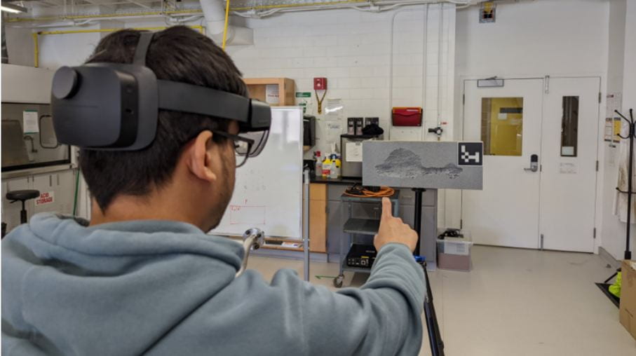
Figure 1: Data collection using gesture control

Figure 2: 3D Mesh reconstruction of the damage
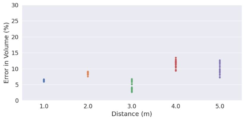
Figure 3: Categorical scatter plots for average error in volume calculation evaluated at different distances
Relevant Publications
- Bajaj, R., Al-Sabbag, Z. A., Yeum, C. M., & Narasimhan, S. (2022). “ Volumetric Damage Quantification For Visual Inspection”, 8th World Conference on Structural Control and Monitoring, Orlando, Florida, USA, 2022.
Students

Rishabh Bajaj