Maritime Infrastructure Inspection
Problem Statement
A large inventory of maritime infrastructure (such as water-spanning bridges, ports, and dams) exists at the land-water interface, presenting an environment where vulnerabilities and deterioration mechanisms occur above and below surface. Traditional methods of inspection center around the use of human divers, though in many cases visibility, safety, and cost factors preclude their effectiveness in collecting objective inspection data. Developing scalable technologies which enable quantitative data collection of these assets in adverse conditions, including Global Navigation Satellite System (GNSS) deprivation, is thus desirable.
Approach
Our approach involves the outfitting of an unmanned surface vessel (USV) with horizontally and vertically mounted lidars, several ruggedized RGB cameras, an IMU, and a multi-beam profiling sonar. By time-synchronizing all sensors, we are able to produce high-quality point cloud maps both above and below the surface of water for downstream inspection applications. For state estimation, a tightly-coupled lidar-visual-inertial (LVI) factor graph-based simultaneous localization and mapping (SLAM) approach is taken, enabling full 6-DoF localization of the USV with respect to its environment. Innovations in the fusion of pre integrated Doppler velocity log (DVL) measurements to the SLAM approach as well as a decoupled mapping framework are proposed.
Ongoing Work:
Ongoing work involves the creation of a lidar-visual-inertial-acoustic dataset that will establish a first-of-its-kind benchmark for evaluating state estimation algorithms and inspection applications for USVs. By extending the hardware configuration to include a consumer-grade DVL, we aim to collect data in a variety of maritime settings, with the full 6 DoF ground truth pose of the USV recovered. This work will also explore potential improvements to sonar to IMU and DVL to IMU extrinsic calibration methods.
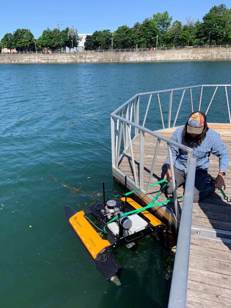
Figure 1. Our USV platform deployed near Welland Canal Bridge 13 in Welland, Ontario

Figure 2. SLAM map produced by our decoupled mapping framework
Relevant Publications
- Thoms, A.*, Earle, G.*, Charron, N., Malama, S., and Narasimhan, S. (2021). Combined Lidar and Sonar Mapping for Partially Submerged Infrastructure. IWHSM Conference, Palo Alto, California, USA, 2021.
Students